40
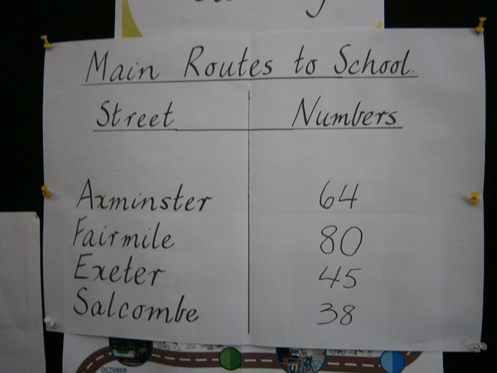
The way we started planning was with a survey of the main routes to school.
This is what we found out:
- Fairmile St 80
- Axminster Rd 64
- Exeter St 45
- Salcombe Way 38
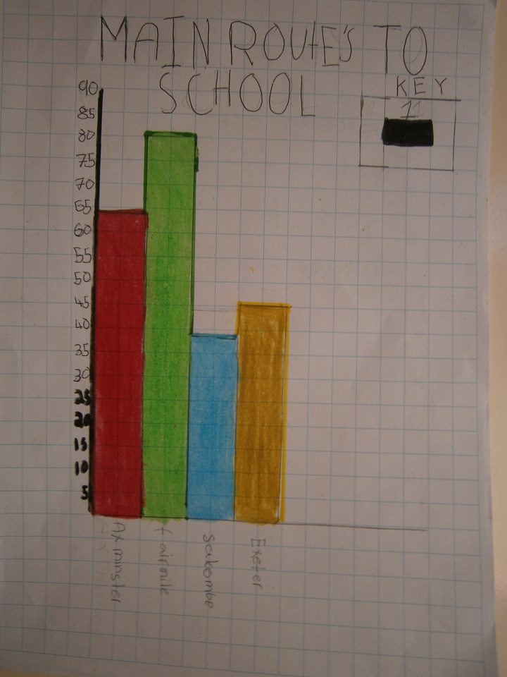
Mitchell compiled this graph of the above data.
We also checked where the Kiss & Drop area is. (It is on Salcombe Way.)
The Access Guide will be useful for people who haven't been coming to school by AT so they will be able to see the popular routes to school. Mitchell.
We talked about the planning for our Access Guide last term so that we were ready to start it straight away in Term 4. We did the survey to give us information on the most used routes to school. We talked about the streets that border our school as being the main routes to school. We want to produce the Access Guide for students for next year so that's why we are getting it ready now. Tori.
Mentor's note: We have some more research to do with our main routes to school (think beyond the school gate!) Then it will be on to the mapping! This Access Guide will be a wonderful contribution by our Team, who have excelled this year, to the school community. We are so proud of your efforts this year.
Discuss this story
2 Comments
Please login to comment
James (Your Move)
I love seeing everyone getting in there on a planning activity - this session earned you 15 activity points. Make sure you do a story when the Access Guide is complete and you'll get lots more!
Report commentArlene
We will, James. We'll use finding out about the components that go together to compile an Access Guide, as a learning activity.
Report comment